
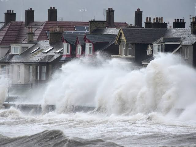
The Met Office has issued a yellow weather warning for wind across parts of north west Scotland on Wednesday, October 14, 2026, forecasting gusts of 50 to 60 miles per hour and isolated gusts approaching 70 miles per hour in exposed coastal and hilly areas. The alert covers the Outer Hebrides and large parts of the Highlands, where the strongest winds are expected late morning and into the early afternoon.
What the Met Office warns and when it applies
The warning, published and materially updated in the early hours of Wednesday, was set to run through the daytime period, with the Met Office advising that winds would ease from the west during the late afternoon and evening. Forecasters highlight the main hazards as difficult driving conditions for high sided vehicles and on exposed routes, the potential for short term loss of power, and the risk of some damage to trees and structures in the most exposed locations.
On its national warnings page the Met Office describes the likelihood of the warning as high and the expected impact as moderate, and it recommends people and organisations in affected areas keep up to date with the forecast, secure loose items outdoors, and take care if travelling. The agency also provides guidance on how to stay safe in strong winds, including avoiding coastal paths and cliff edges while conditions are severe.
Why the UK will see strong winds this week
Meteorologists say the windy conditions are driven by a deep area of low pressure tracking across the North Atlantic and interacting with a strong jet stream. The Atlantic system has brought a compact band of very strong winds that will most directly affect the north west of Scotland, where the combination of exposed coastline and elevated terrain amplifies gust speeds.
National weather services and major news organisations covering the forecast note that the pattern is part of a familiar autumn sequence, when vigorous Atlantic depressions commonly produce spells of gales in northern and western Britain. Forecasters expect milder than average temperatures to continue for much of the country even as the wind and bands of rain move through.
Local effects and practical impacts
Local councils, transport operators and emergency services typically prepare for yellow warnings by reviewing resource plans and advising the public on travel. High sided vehicles, cyclists and pedestrians face the greatest immediate danger on exposed bridges and waterfront roads. Ferry operators serving island communities may adjust timetables if conditions make crossings unsafe, while councils may close vulnerable coastal promenades and outdoor event organisers often postpone or alter activities.
Power disruption is a known risk during gusts of the size forecast, because falling trees and debris can damage overhead lines. The Scottish and southern Highlands have a significant rural population that relies on single feed lines, which can take longer to repair during high wind events. Utility companies say their field teams are placed on alert to respond quickly to outages but ask customers to be ready for short interruptions and to report outages through normal channels.
Advice for residents and travellers
- Check live forecasts and local travel updates before setting off, particularly if your route travels along coastlines, over high ground or across exposed bridges.
- Secure garden furniture, trampolines, and other loose items that could become airborne.
- Avoid driving high sided vehicles where possible, and take extra care on motorbikes and bicycles.
- If you live in rural areas, be prepared for temporary power interruptions and avoid standing beneath trees during a gale.
Transport for the north and west of Scotland and local ferry operators publish service notices on their websites and social feeds. Anyone planning outdoor activities should evaluate whether they can safely proceed or should be postponed until winds subside.
How this sits within the seasonal picture
The arrival of a strong Atlantic low is not unusual for mid October, though the precise strength and track of each system is important for impacts onshore. The Met Office has placed this event in an operational context, warning that gusts of the scale forecast are likely in exposed northern and western districts but that most populated lowland areas will see much milder effects.
For decision makers the balance is always between precaution and disruption. A yellow warning denotes a realistic chance of disruption rather than the widespread, severe impacts indicated by amber or red warnings. Still, the concentrated nature of the strongest gusts means local authorities, island communities and rural residents in the Highlands should take the forecast seriously and act to reduce avoidable risk.
Visitors and commuters travelling through Scotland during Wednesday should allow extra time for journeys and check with transport providers. The Met Office will continue to update forecasts and warning details as the system moves east and weakens through the afternoon and evening.