Trough of Super Typhoon Choi-Wan brings heavy rains to Visayas and Mindanao, state weather agency warns
The Philippine weather bureau says a trough associated with Super Typhoon Choi-Wan will deliver scattered to at times heavy rains across the Visayas and Mindanao on October 5, raising risks of flash floods and landslides and prompting local advisories.
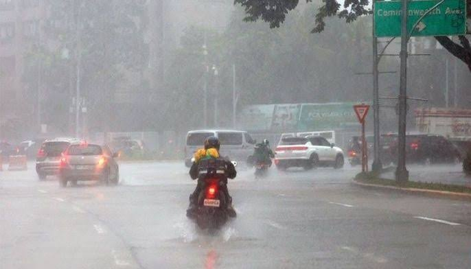
The Philippine Atmospheric, Geophysical and Astronomical Services Administration said on Monday that the trough of Super Typhoon Choi-Wan is affecting large parts of the Visayas and Mindanao, bringing cloud cover and scattered, at times heavy, rainfall that could trigger flash floods and landslides. PAGASA reported that as of early Monday the system, identified internationally as Choi-Wan, remained well outside the Philippine Area of Responsibility but its atmospheric trough was already influencing weather over central and southern islands. The agency gave a location for the tropical cyclone and described it as a super typhoon with maximum sustained winds near the center at about 195 kilometers per hour and gusts up to 240 kilometers per hour. Forecasters said the trough will produce cloudy skies with scattered rainshowers and thunderstorms across Western Visayas, Central Visayas, the Negros Island Region, Leyte, Southern Leyte, Caraga, and parts of northern Mindanao. Localized heavy downpours are possible, especially in upland and flood prone communities, increasing the chance of sudden floods and slope failures where soils are already saturated. Regional forecasts advised residents and local governments to remain alert to rapidly changing conditions. The national weather service recommended that communities monitor local advisories, secure loose outdoor items, and prepare evacuation routes and emergency kits. Coastal areas were also warned to expect rough seas and higher waves associated with enhanced winds and the outer rain bands of the system. Why this matters Choi-Wan is notable for its intensity, with agencies classifying it as a super typhoon in the western North Pacific basin. Even when the storm center remains well offshore, the extended cloud bands and troughs these systems produce can cause significant rainfall over the Philippines because of the archipelagos exposed geography and complex terrain. Heavy rains in the Visayas and Mindanao have in past seasons led to rapid-onset flooding and landslides that disrupt communities, damage infrastructure, and interrupt agriculture and transport. The Philippines sits in one of the worlds most active tropical cyclone basins, and its disaster response agencies say early local preparation is essential to reduce harm. Government departments at national and regional levels typically issue situational alerts, preposition relief items, and ready evacuation centers when persistent heavy rains are forecast. Local impacts and responses On Monday morning, regional civil defense offices and provincial governments in affected areas began refreshing local advisories. Transport authorities cautioned mariners about worsening sea conditions on routes linking island provinces, and some localities signaled businesses and schools to monitor announcements about suspensions or closures if rainfall increases. Agricultural authorities also noted that prolonged heavy rains can damage standing crops and disrupt harvesting schedules. Farmers in low lying and riverine areas were urged to move livestock and farm inputs to higher ground where possible and to keep drainage channels clear. Forecast outlook and uncertainty PAGASA indicated that Choi-Wan itself remained outside the Philippine Area of Responsibility and was moving northward, but forecasters emphasized that the trough associated with the storm would continue to affect rainfall distribution over central and southern regions through the coming days. The exact intensification and track of oceanic tropical cyclones can change rapidly, and monitoring agencies, including PAGASA and international partners, will issue updated advisories as new satellite and model data arrive. Residents are advised to follow updates from the official DOST PAGASA channels and from their local government units. Emergency hotlines and regional disaster response centers remain on alert to assist evacuations and relief operations if necessary. Context and regional implications A super typhoon of Choi-Wans strength has potential regional consequences beyond the Philippines. Its large circulation can alter monsoon patterns and influence weather across neighboring countries and maritime zones. For the Philippines, which often endures multiple cyclones each year, the main near term danger is heavy rainfall from peripheral troughs and rain bands, not necessarily direct landfall. Climate scientists and disaster management experts continue to point to the importance of strengthening early warning systems and resilient infrastructure to reduce loss from extreme weather. As the season progresses, authorities say they will maintain contact with communities in vulnerable areas and keep humanitarian and emergency services prepared. What to watch for next PAGASA will issue routine tropical cyclone advisories and regional forecasts through the day. Local governments will decide on school and work suspensions and on the activation of evacuation centers based on evolving rainfall and flood reports. Mariners should monitor maritime advisories, and communities near rivers and steep slopes should be ready to move if local alarms are sounded. The trough of Super Typhoon Choi-Wan is the current significant weather concern for central and southern Philippines on October 5, and officials say timely vigilance and preparation remain the best defense against sudden flooding and landslides.
Topics
LocationVisayas and Mindanao, PH